Subsurface Engineering · Est. 1994

Every property
sits on water.
The question is
who you trust
to reach it.

Bore puts a licensed hydrogeologist, a thirty-year driller, and a certified water quality specialist on every job — because what's beneath your land deserves more than a guess.

847ft

Deepest bore on record

1,200+

Wells completed

98.4%

First-strike success rate

30yr

Field experience

The People Behind Every Bore

This is what three specialists look like on a single job site.
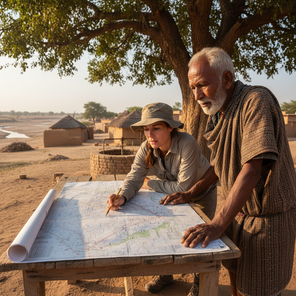
Dr. Margaret Calloway, licensed hydrogeologist, standing in field with geological maps

Licensed Hydrogeologist

Dr. Margaret Calloway

PG #47821 · 22 years subsurface mapping

"Before a drill bit touches soil, Margaret has mapped the aquifer."

Using resistivity surveys, geophysical logs, and regional basin data, Margaret identifies the exact formation where water will be found — and at what yield. Her aquifer assessments have a 98.4% first-strike success rate across limestone, fractured shale, and alluvial deposits.

Geological Cross-Section · Typical Hill Country Profile

Topsoil & Clay
0–40 ft
Limestone / Caliche
40–120 ft
Shale Band
120–160 ft
Fractured Limestone
160–220 ft
▼ AQUIFER ZONE
220–280 ft

* Depths vary by property. Margaret's assessment identifies your specific profile before drilling begins.
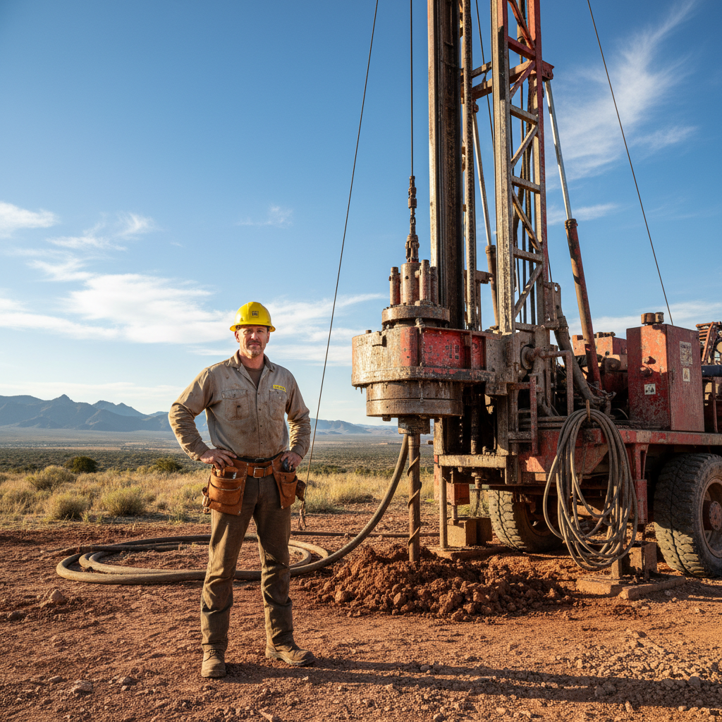
Ray Thibodaux, master well driller, wearing hard hat at a drill site

Master Well Driller

Ray Thibodaux

Licensed Driller · 31 years · 1,200+ bores completed

"Thirty-one years. Every formation. Zero shortcuts."

Ray has drilled through Austin Chalk, Carrizo Sand, Trinity Aquifer limestone, and Woodbine sandstone. His depth record is 847 feet on a Hill Country ranch with a fractured Edwards formation. He's never walked away from a bore that Margaret said held water.

Selected Bore Record · 31-Year Field Log

1993
280 ftAlluvial gravel
East Texas basin·First solo bore
1998
412 ftAustin Chalk
Williamson County·Record yield that year
2004
560 ftCarrizo Sand
Atascosa County·Commercial irrigation system
2011
683 ftTrinity Aquifer limestone
Kendall County·Ranch water system
2018
791 ftWoodbine sandstone
Wise County·Subdivision supply bore
2023
847 ftEdwards fractured limestone
Kerr County·Personal depth record
Denise Okafor, water quality specialist, analyzing water samples in laboratory setting

Water Quality Specialist

Denise Okafor

CWS-IV · TCEQ Certified · Post-drill testing & treatment

"The water that reaches your tap has been tested 14 ways."

Denise runs a 14-parameter post-drill analysis covering coliform bacteria, nitrates, pH, hardness, arsenic, iron, and eight additional markers. She designs the treatment system — if any is needed — and certifies the well for its intended use before the crew leaves the property.

14-Parameter Post-Drill Analysis · EPA-Certified Methods

01Coliform Bacteria
EPA Method 9223B
02Nitrates & Nitrites
EPA Method 353.2
03pH & Alkalinity
SM 4500-H+B
04Total Hardness
SM 2340C
05Arsenic
EPA Method 200.8
06Iron & Manganese
EPA Method 200.7
07TDS & Conductivity
SM 2510B
08Turbidity
SM 2130B

Results delivered within 5 business days. Treatment system design included at no additional cost.

Subsurface Knowledge

We've drilled every formation this region puts in the way.

Limestone doesn't stop us. Shale bands don't reroute us. Fractured formations are where we find the best yields. Thirty years of logs mean no formation is a surprise.

Formation Library · Regional Coverage

Austin Chalk

180–320 ft · Moderate

8–25 GPM

typical yield

Carrizo Sand

300–480 ft · Accessible

15–60 GPM

typical yield

Trinity Limestone

400–650 ft · Challenging

5–20 GPM

typical yield

Woodbine Sandstone

550–820 ft · Deep

10–35 GPM

typical yield

Edwards Fractured

200–850 ft · Expert

20–200 GPM

typical yield

Performance Record · Since 1994

Deepest bore completed
847 ft
Wells successfully completed
1,200+
First-strike aquifer success
98.4%
Formation types on record
14

"We don't drill where we hope there's water. We drill where the geology says there is."

— Dr. Margaret Calloway, PG

Field Results

What it looks like when the drill hits the water table.

Rural Residential

Halstead Family Ranch

Kerr County, TX

312 ft

bore depth

$8,600/yr

outcome

Formation: Edwards Limestone

Before Bore

Hauling 800 gallons/week by truck at $0.18/gallon

After Bore

22 GPM yield at 312 ft · Edwards limestone formation

"First water we've owned in fifteen years on this land."

D
Dale Halstead
Commercial Agriculture

Mesquite Creek Farms

Gonzales County, TX

480 ft

bore depth

340 acres irrigated

outcome

Formation: Carrizo Sand

Before Bore

Low-yield municipal connection capped at 40 acre-feet/season

After Bore

85 GPM yield at 480 ft · Carrizo sand · Unlimited draw rights

"We planted cotton for the first time in six years."

P
Priya Nair, Operations Manager
Commercial Development

Ridgeline Subdivision — Phase 2

Williamson County, TX

390 ft avg

bore depth

47 lots activated

outcome

Formation: Austin Chalk

Before Bore

47 lots with no municipal water access at property line

After Bore

2 production wells · 110 GPM combined · 47 lots served

"Bore turned a stalled project into a closed subdivision."

M
Marcus Webb, General Contractor
Begin Your Assessment

The first step is knowing what's beneath your land.

A site assessment takes two hours and tells you exactly what formation sits below your property, what yield to expect, and what the bore will cost. No obligation.

Schedule Your Site Assessment

Include county if rural parcel with no street address

No obligation. Assessment fee of $150 is waived when you proceed with drilling.

Free Resource

Download Your County's Aquifer Report

Bore's hydrogeology team has compiled formation maps, depth ranges, and yield estimates for 28 counties. Enter your zip code and we'll send your county's report instantly.

What Every Assessment Includes

🗺️

Geophysical survey of your specific parcel

📊

Aquifer depth and yield estimate in writing

💰

Fixed-price bore quote — no hidden mobilization fees

📋

Formation report signed by Dr. Calloway (PG)

🔒

Assessment fee waived on drilling contract

Speak Directly

(512) 555-0198

Mon–Fri 7am–6pm CT · Sat 8am–2pm

drill@borewater.com